

Environmental solutions, engineered right.
Our Services
Our services are built on a commitment to accuracy, safety, and cost-effective results—from environmental consulting and remediation, to data modeling and advanced site intelligence.


-
We conduct Phase I ESAs in accordance with ASTM E1527 standards to evaluate current and historical uses of a property and its surroundings. In New Jersey we perform NJDEP compliant Preliminary Assessments (PA) and when compiled with the ESA scope of work this provides innocent purchaser protections from both the Federal and NJ State Governments. These ESA and PA investigations include site inspections, historical records review, regulatory database searches, and interviews — all aimed at identifying Recognized Environmental Conditions (RECs) and / or Areas of Concern (AOCs) that may impact property value or compliance.
-
If RECs or AOCs are present on site and potential contamination is suspected, our team performs Phase II Site Investigations (SI) to collect soil, groundwater, or vapor samples. These assessments determine whether contamination is present. If so, then extended Phase II and Remedial Investigations (RI) are prefromed to determine the extent of contamination and evaluate site conditions to determine the best remediation strategy for the Site. SI and RI results inform risk management decisions for compliance, property transactions, or development.
-
RSRAs are useful for lenders and low-risk property transactions. We assess environmental risk using historical land use records and environmental databases to determine if further investigation (like a Phase I) is warranted.
-
We provide strategic guidance throughout the due diligence process — from risk identification to mitigation planning and stakeholder communication. Our goal is to help clients make informed investment decisions and avoid unexpected environmental costs.

-
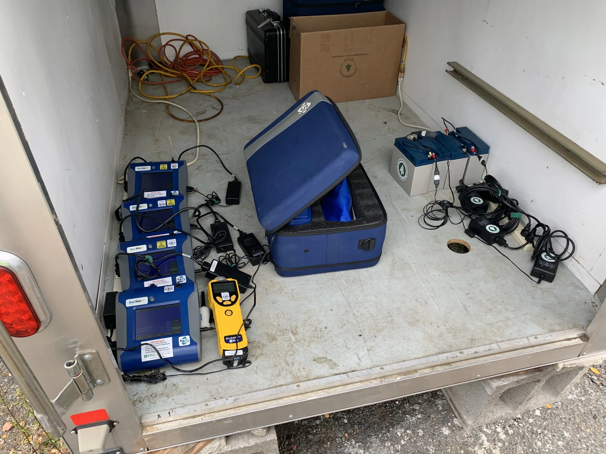
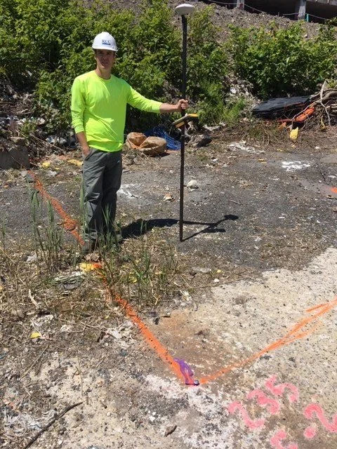
We begin by gathering data on site geology, hydrology, and the potential contaminant sources from due diligence data and literature sources. These data identify areas of concern and what is the appropriate sampling means and methods consistent with regulations and project objectives. The appropriate sampling is performed to determine if any media contains compounds of concern above regulatory standards within or emanating from the RECs or AOCs.
-
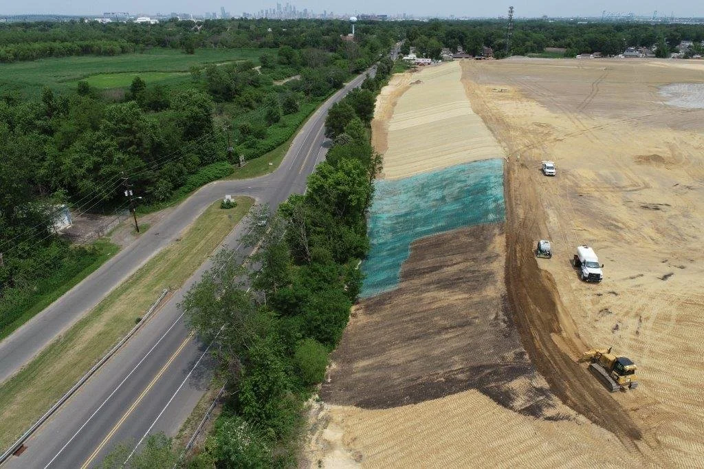
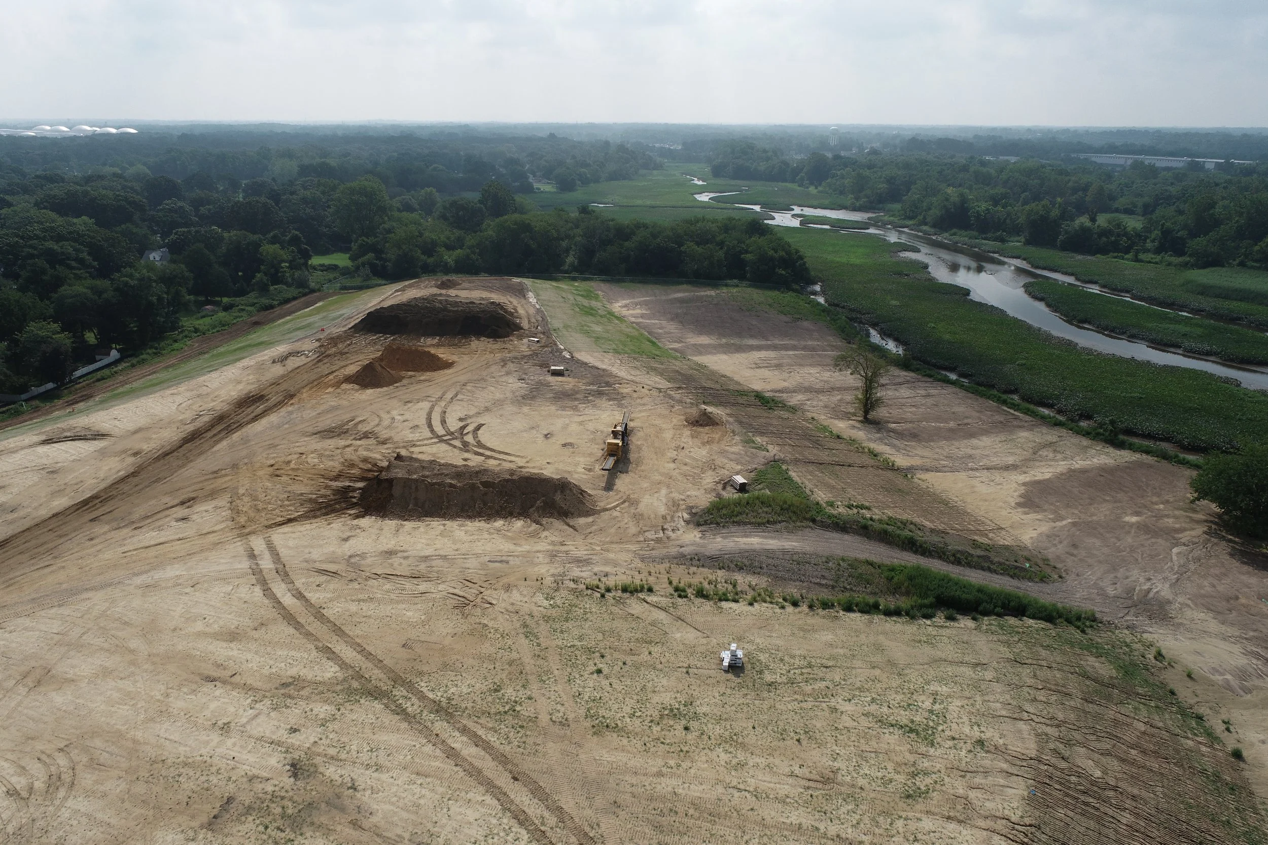
When contamination is confirmed, we perform comprehensive investigations to delineate the impacts within all the affected media. This can include high-resolution sampling, pilot testing and modeling to evaluate risks and inform the design of effective, site-specific remediation plans that meet client business objectives.
-
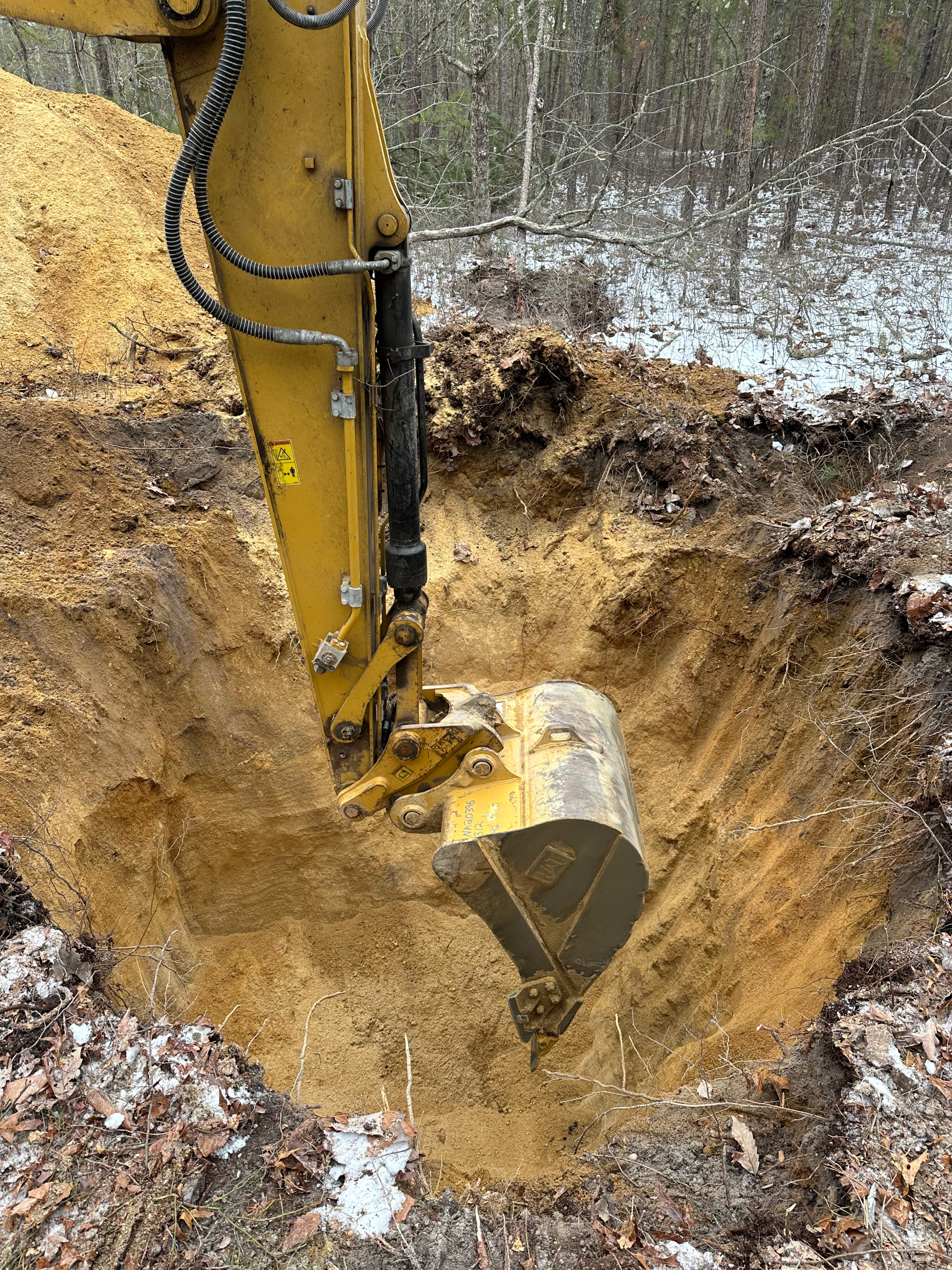
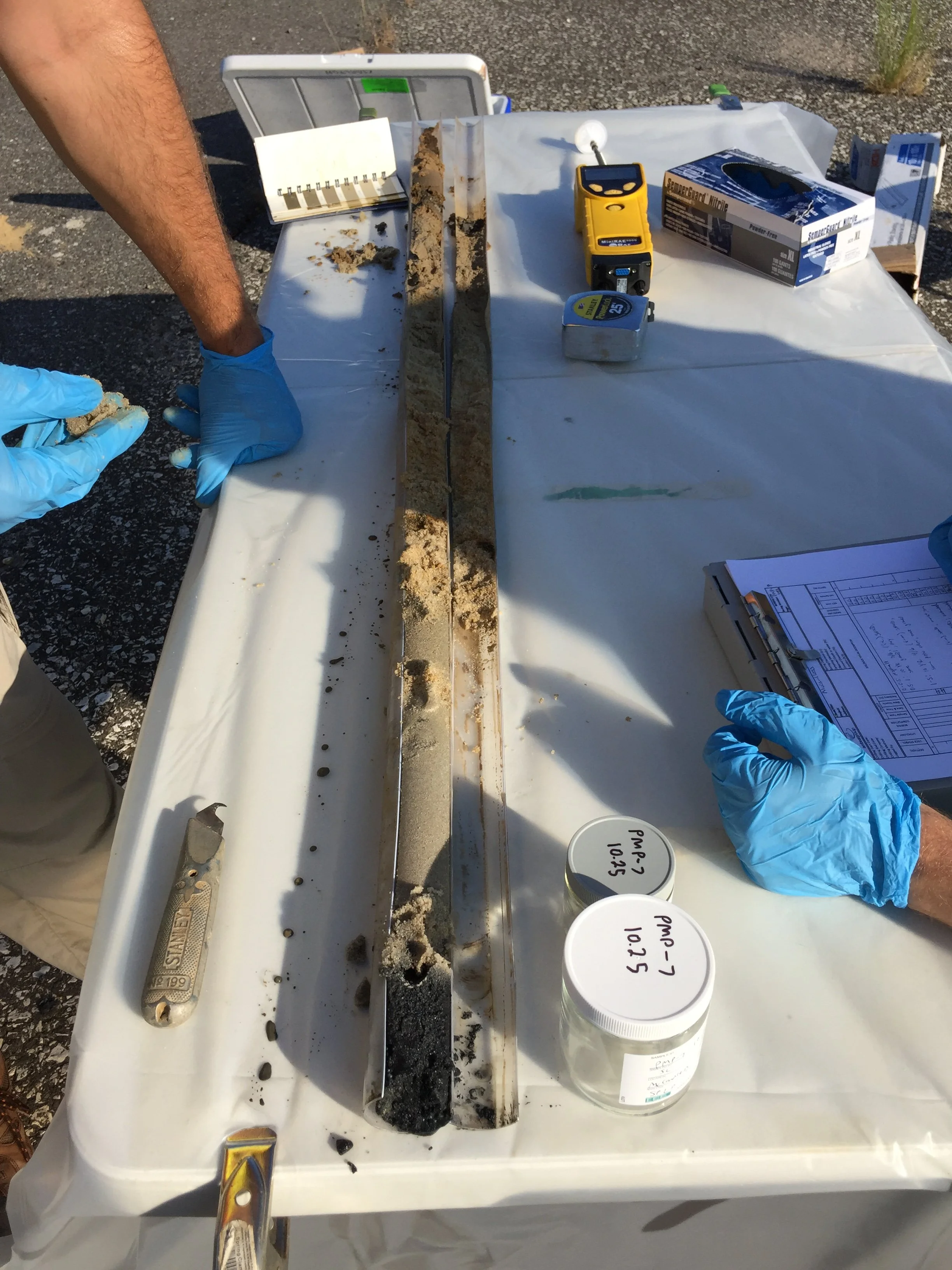
Our project teams develop soil plans to efficiently assess soil contamination and characteristics. The soil sampling plans can be dynamic and adapt as data is collected in the field. Screening techniques guide sample collection for laboratory confirmative and certified analysis. Soil borings are logged and samples for physical characteristics that affect absorption, porosity and conductivity within the soils. This data helps inform next steps for soil characterization, groundwater investigation plans, remedial strategies and redevelopment planning.
-
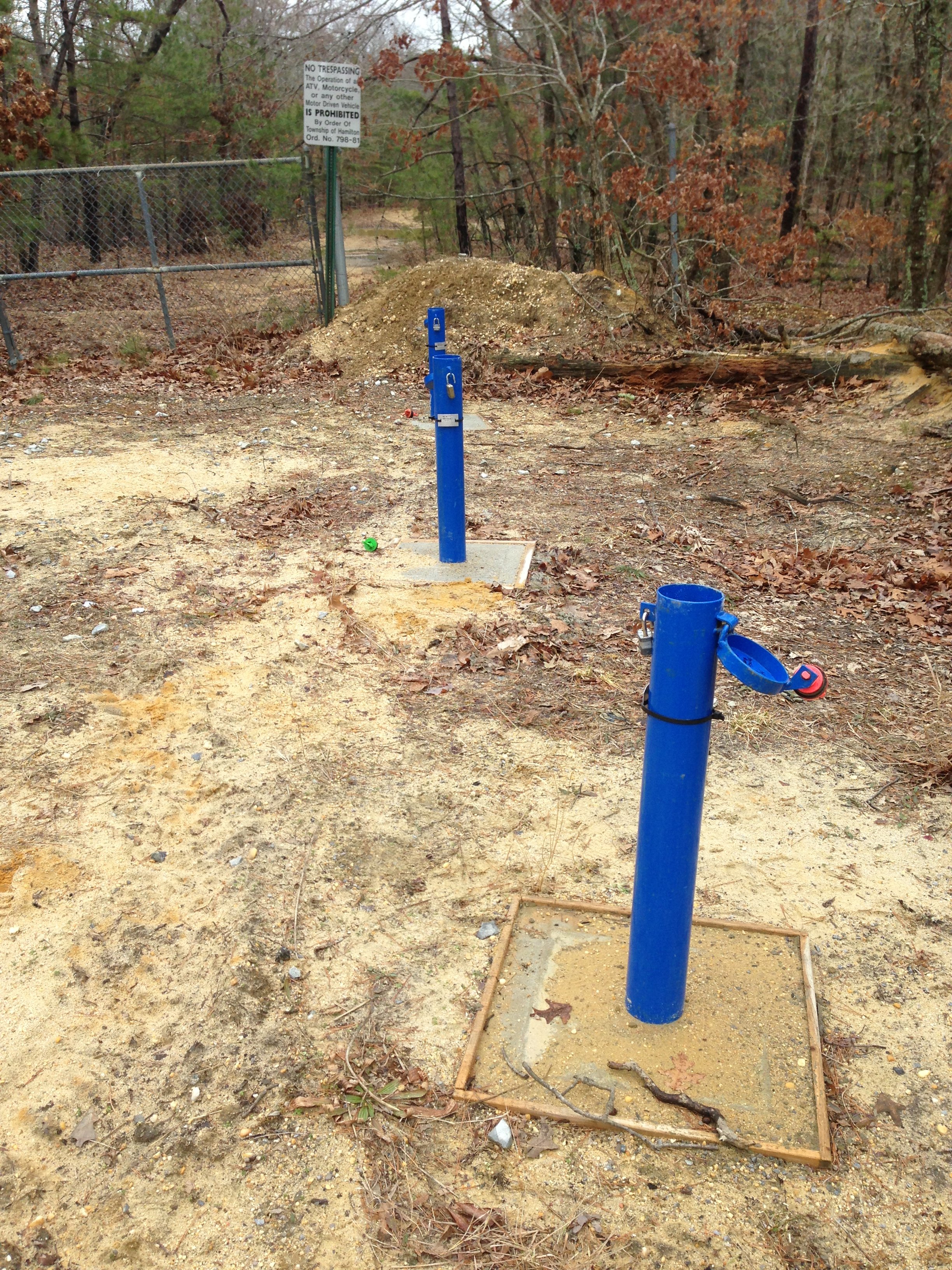
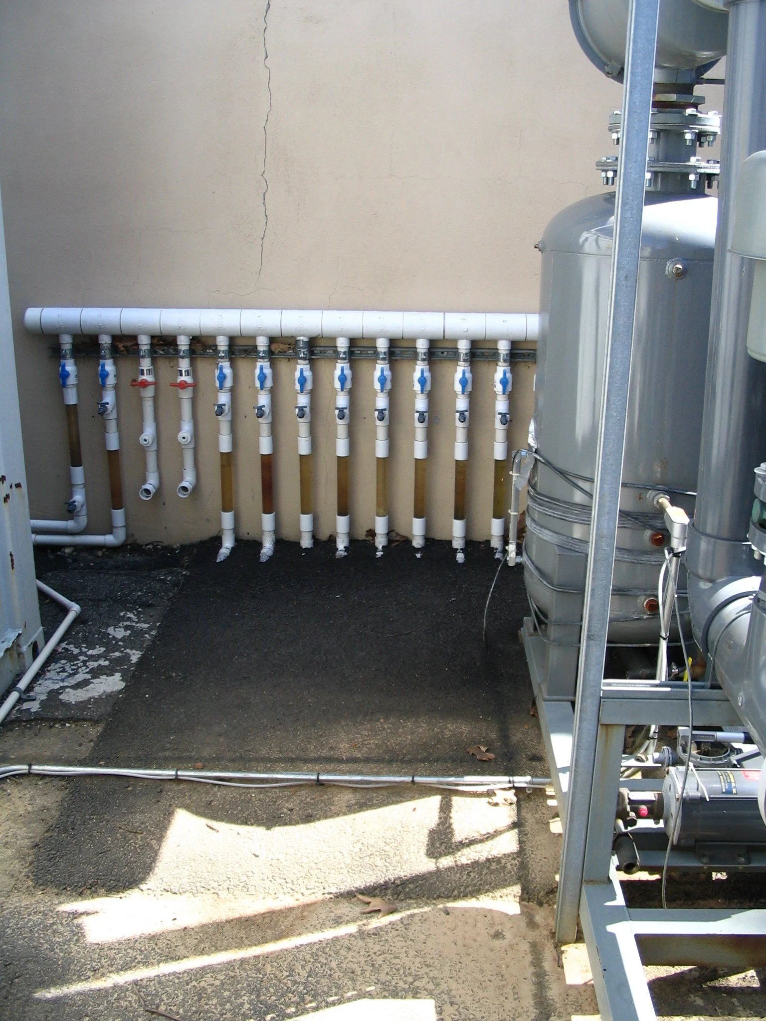
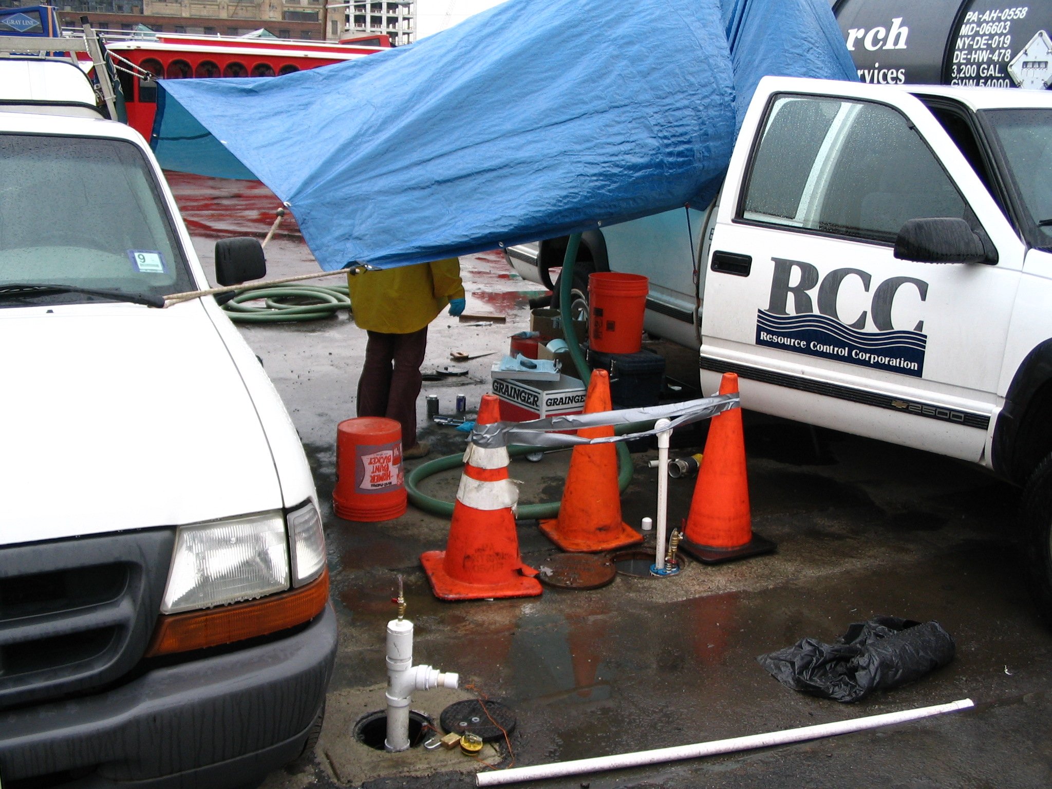
Once a groundwater investigation is required, our project teams develop work plans using both temporary and permanent groundwater sampling and monitoring wells or points. These are used to evaluate chemical concentrations, groundwater flow, and plume geometry. Aquifer testing can be performed using various means and methods to evaluate contaminant fate and transport scenarios. Understanding groundwater conditions is critical for evaluating human health risks, protecting nearby water resources, and meeting regulatory requirements.
-
We assess whether volatile contaminants in soil or groundwater have the potential to or are migrating into buildings. This includes sub-slab vapor sampling and indoor air testing, often in response to regulatory concerns or redevelopment plans.
-
We design tailored remediation plans based on detailed site data, regulatory standards, and client goals. Whether the objective is site closure, redevelopment, or risk reduction, our team selects cost-effective, proven technologies to meet cleanup requirements and timelines.
-
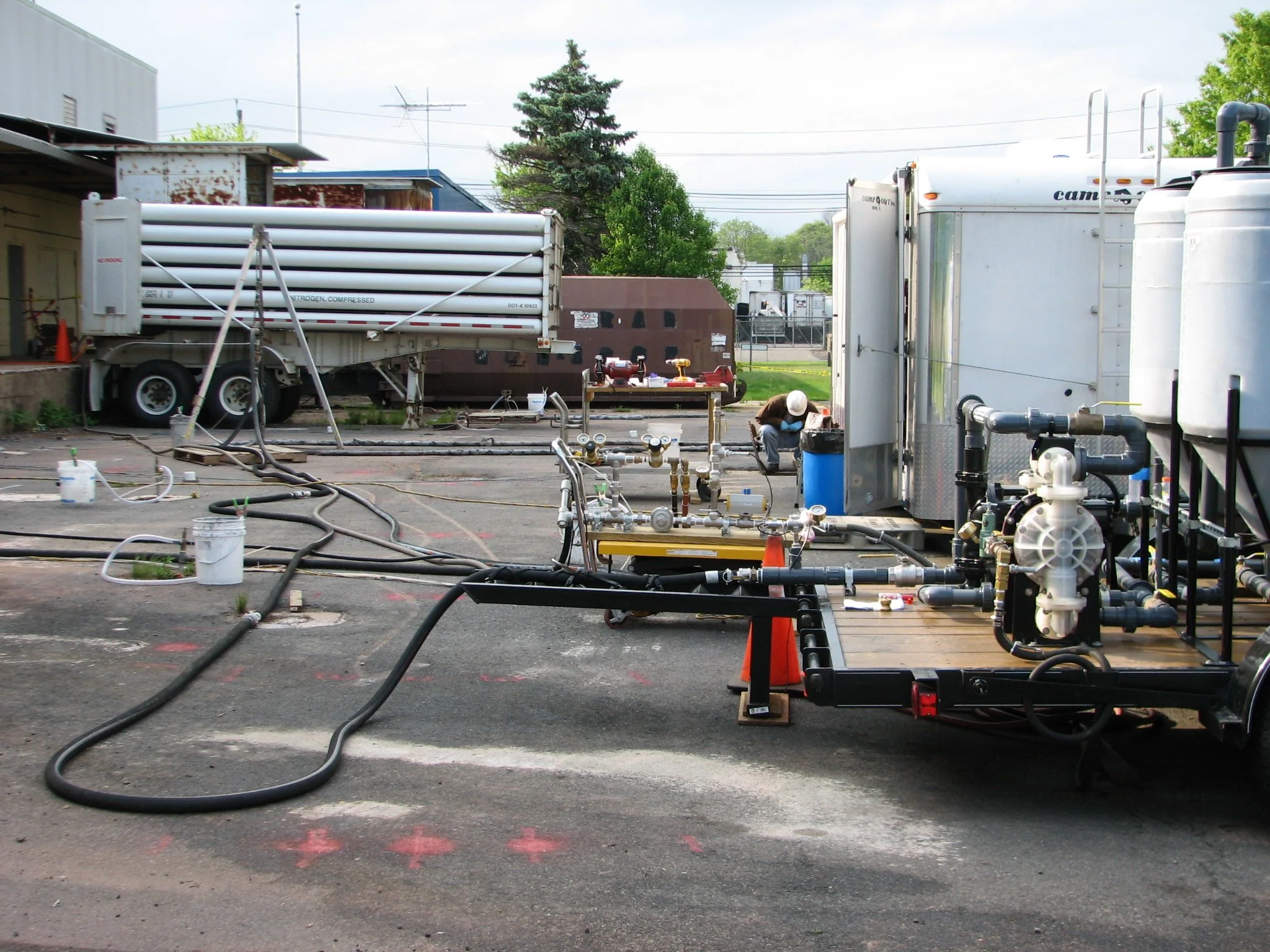
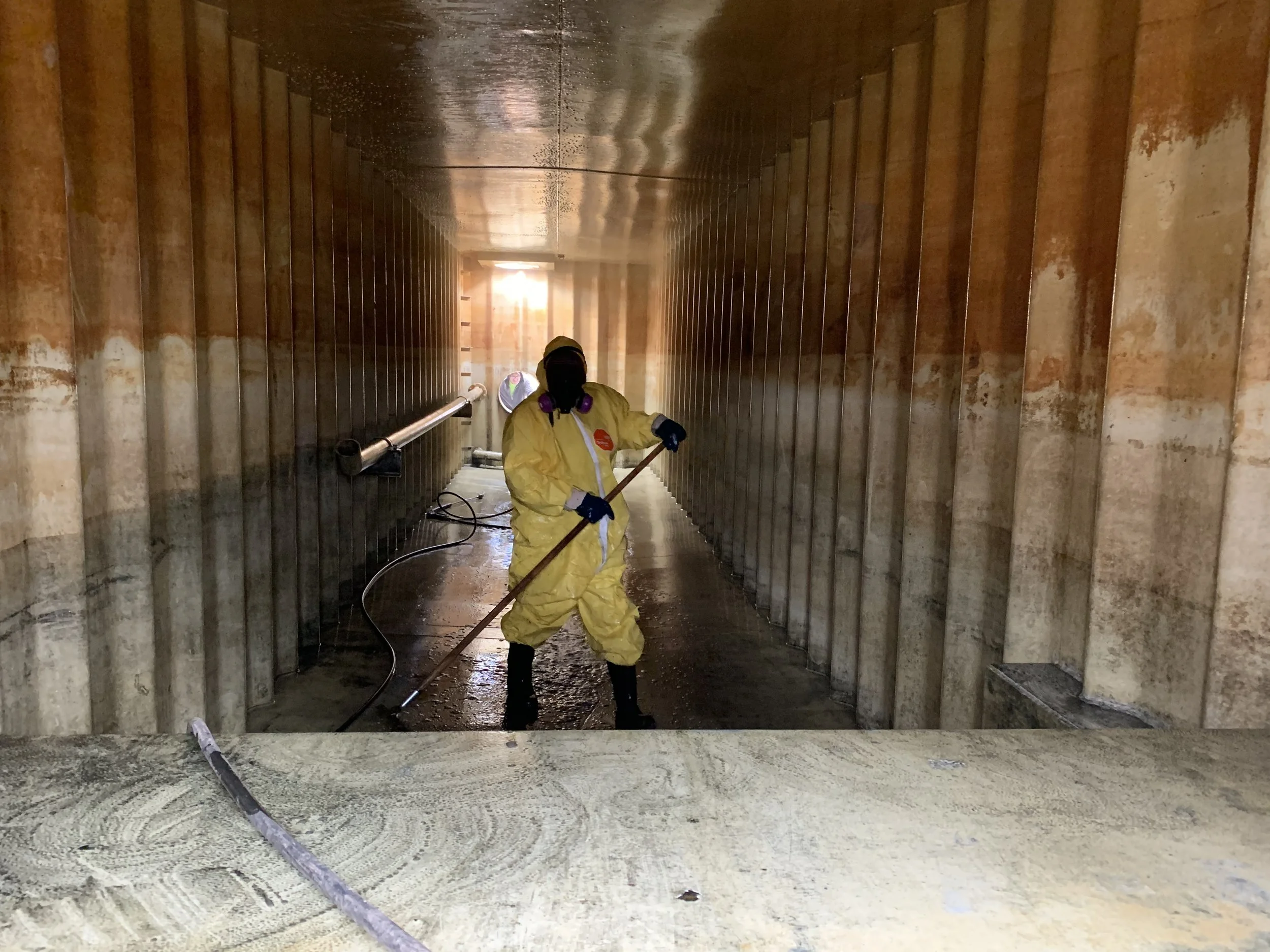
We implement chemical, biological, or physical treatment methods directly in soil or groundwater. Techniques include in-situ chemical oxidation (ISCO), bioremediation, and soil vapor extraction. In-situ methods reduce site disruption and are often ideal for active properties or limited-access areas.
-
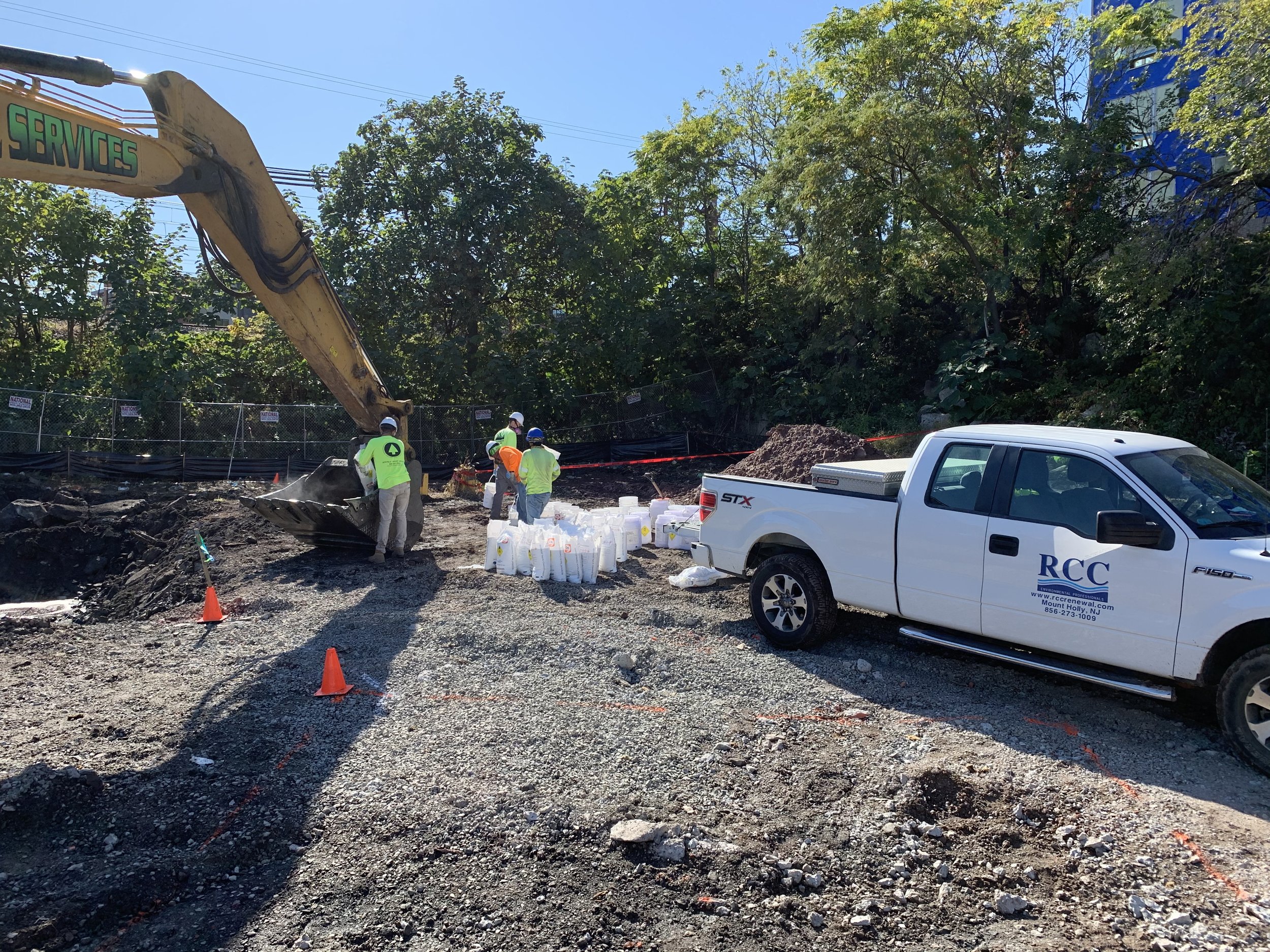
For situations requiring excavation, we coordinate soil removal, transport, and off-site disposal or treatment. Ex-situ methods are often used when contamination is concentrated or near the surface, offering faster results and permanent contaminant removal.
-
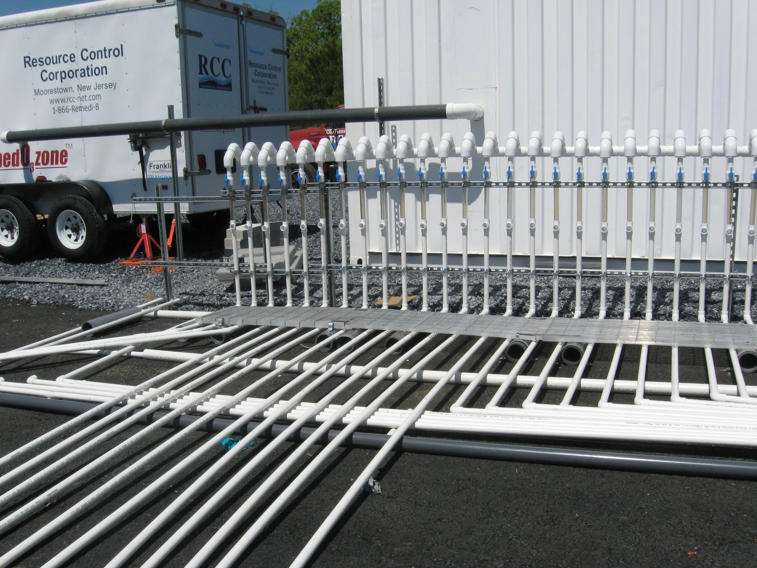
We design, install, and maintain pump-and-treat systems, permeable reactive barriers, and other technologies to remediate groundwater plumes. Our solutions are built for long-term performance and regulatory compliance.
-
Our team designs and installs systems to mitigate vapor intrusion from subsurface contamination. These include sub-slab depressurization systems, vapor barriers, and active venting technologies — often used in residential, commercial, and redevelopment settings.
-
Post-remediation, we provide routine system inspections, sampling, performance evaluation, and reporting to regulatory agencies. OM&M is critical for meeting long-term cleanup goals, ensuring system reliability, and achieving regulatory closure.

-
We assist with identifying, preparing, and submitting permit applications across federal, state, and local agencies. This includes air, water, stormwater, wastewater, hazardous materials, and land disturbance permits. We help clients navigate complex permitting processes and avoid costly delays.
-
Our audits identify non-compliance issues and potential risks, providing actionable recommendations to correct deficiencies. These assessments can be conducted voluntarily or in preparation for agency inspections, acquisitions, or internal reviews.
-
We help clients properly manage hazardous substances in accordance with RCRA, EPCRA, and state regulations. This includes waste characterization, manifest documentation, storage area inspections, and training programs.
-
We prepare SPCC plans per EPA guidelines for facilities that store oil or hazardous substances. Services include site evaluations, secondary containment design, plan certification, and employee training.
-
We represent clients in communications with local, state, and federal agencies, including responding to notices of violation, negotiating compliance schedules, and managing reporting obligations. Our goal is to reduce risk and maintain cooperative regulatory relationships.
-
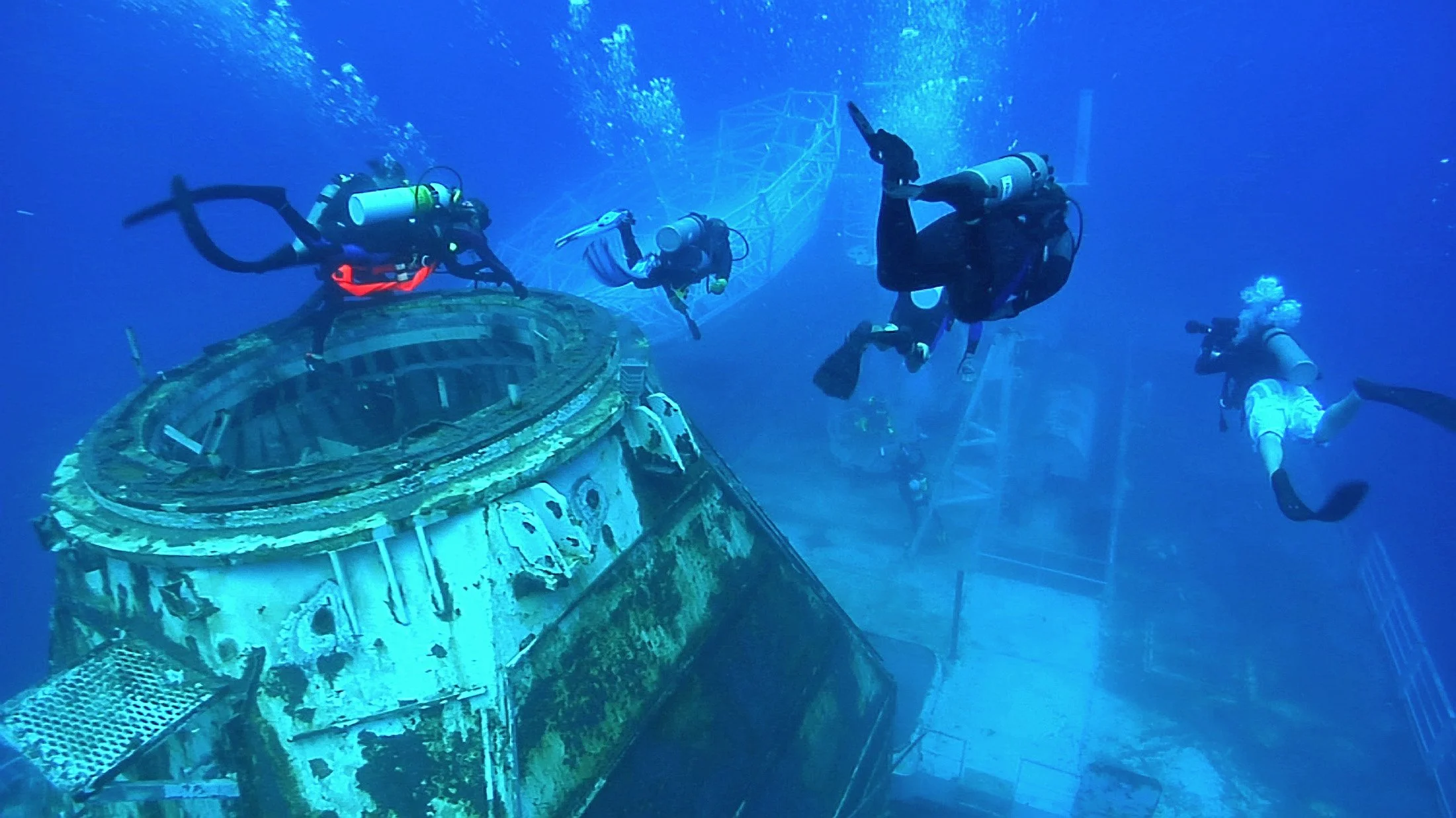
We assist in the planning, permitting, and deployment of artificial reefs using decommissioned vessels, concrete structures, or purpose-built modules. Our services include site selection, ecological assessments, materials certification, and coordination with regulatory agencies to ensure compliance with federal and state environmental standards. These projects support marine conservation, fisheries enhancement, and ecotourism opportunities.
-
We guide clients through the TSCA (Toxic Substances Control Act) compliance process — particularly the inspection, sampling, and remediation of PCBs and other regulated materials on vessels. This is essential when foreign-flagged ships are reflagged for U.S. operation or before artificial reefing or dismantling. Our team conducts materials testing, documentation, and coordination with the EPA to support deflagging, import approvals, or environmentally sound vessel retirement.
-
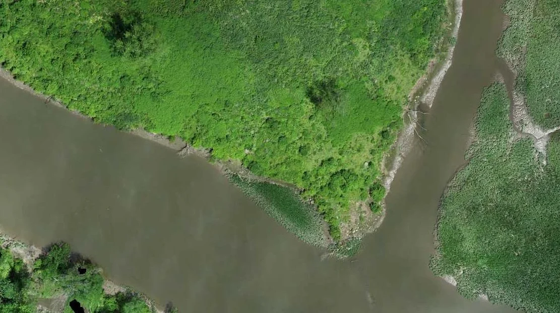
We provide GIS consulting services tailored to environmental applications, including wetland delineation mapping, sensitive area overlays, land use analysis, and regulatory buffer modeling. Our geospatial products support NEPA documentation, permit submittals, and environmental impact assessments — ensuring spatial data aligns with federal, state, and local regulatory requirements.
-
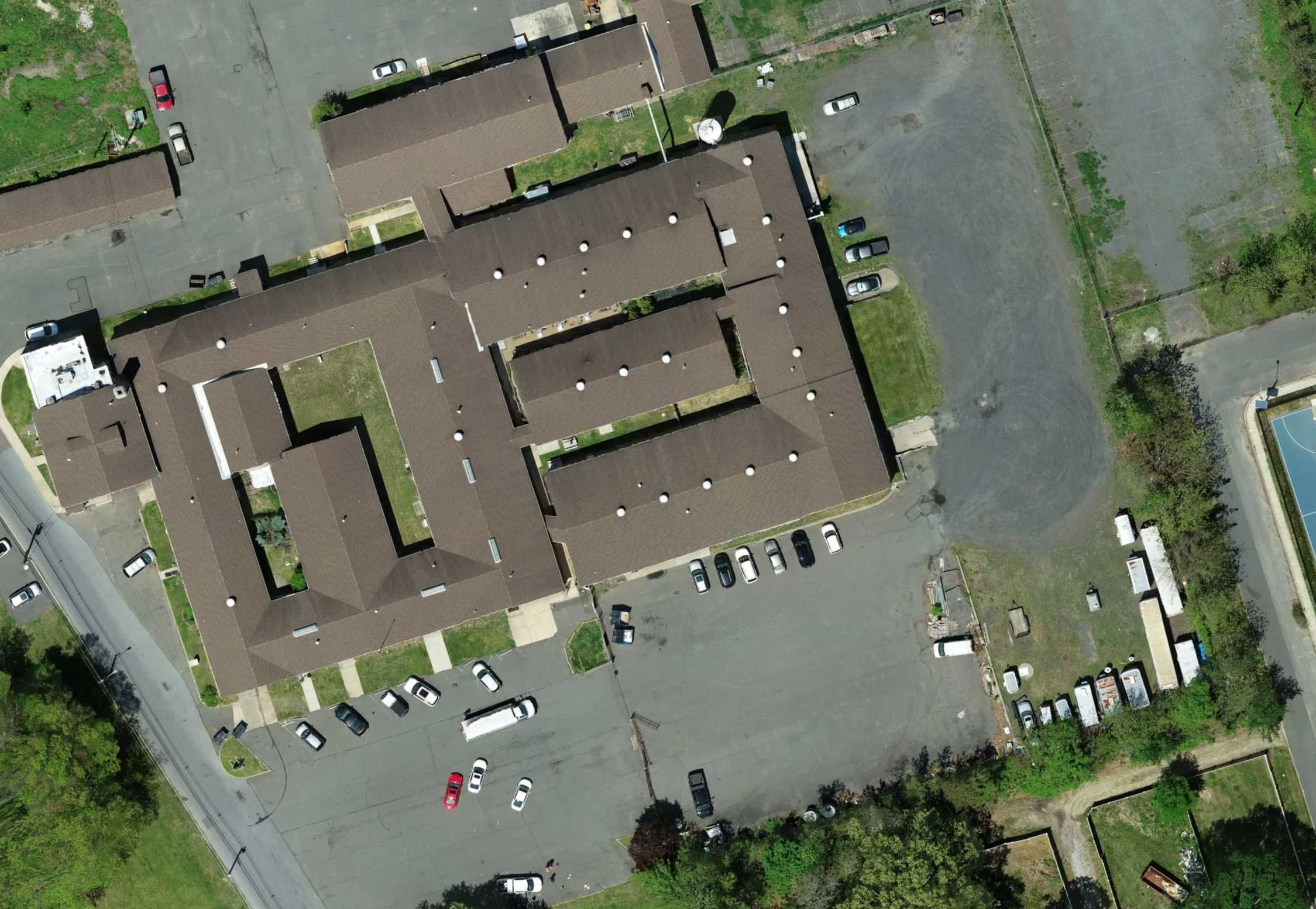
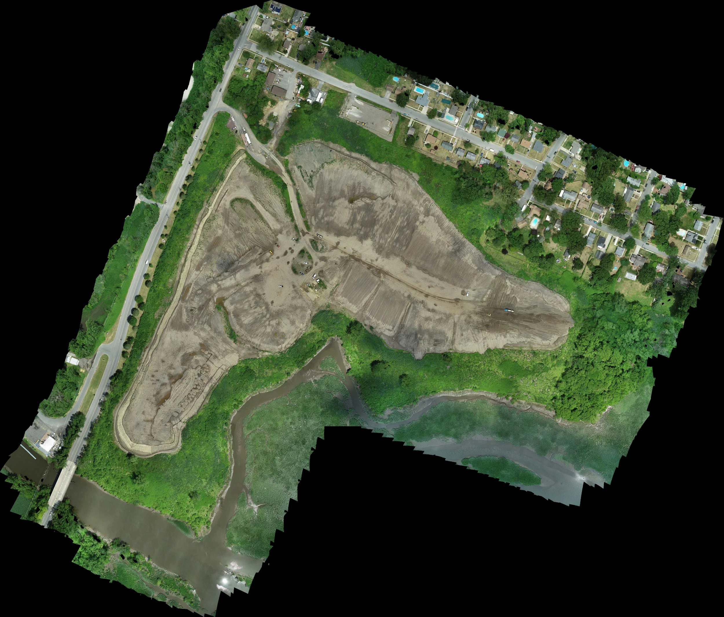
Our FAA-licensed drone operators capture detailed aerial imagery, orthomosaics, thermal data, and 3D terrain models. This enhances site visibility for vegetation mapping, erosion monitoring, construction progress tracking, and inspection of hard-to-access areas — with rapid turnaround and minimal site disturbance.
-
Using aerial photogrammetry and LiDAR data, we build detailed 3D models of terrain, infrastructure, and environmental features. These models support volume calculations, floodplain assessments, remediation design, and stakeholder communication — turning complex site data into intuitive, actionable visuals.